
History, 24.02.2021 21:20 elijahjacksonrp6z2o7
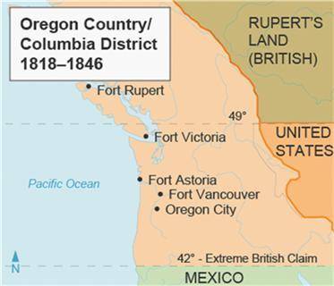
This map shows the Oregon Country.
The most important information shown on this map is that
Mexico was about to build a series of forts and take over the fur trade.
many forts had been built in the Oregon Country to control the fur trade.
Great Britain was in control of a large territory known as Rupert’s Land.
the Oregon Country was bordered to the west by the Pacific Ocean.

Answers: 3


Other questions on the subject: History
History, 22.06.2019 07:30, chickenhead123
Plz . explain what shopping was like in london during the early 1900s. how does this differ from the modern shopping experience?
Answers: 2
You know the right answer?
This map shows the Oregon Country.
The most important information shown on this map is that
Questions in other subjects:

Geography, 21.10.2020 20:01
Geography, 21.10.2020 20:01

History, 21.10.2020 20:01

English, 21.10.2020 20:01

World Languages, 21.10.2020 20:01

Chemistry, 21.10.2020 20:01


