
History, 08.12.2020 03:00 bacchus6663
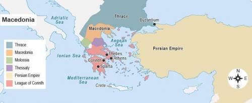
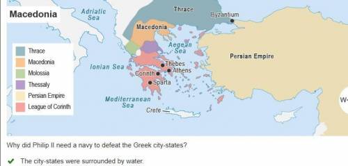
This map shows Macedonia and the Greek city-states. A map titled Macedonia. A key shows Macedonia and Greek city-states by color. The shaded areas are bordered by the Aegean Sea, Ionian Sea, and Mediterranean Sea. Why did Philip II need a navy to defeat the Greek city-states? The city-states were surrounded by water. Most city-states were located on islands. Most city-states were located across the Aegean Sea. The city-states had allies near the Mediterranean Sea. Mark this and return

Answers: 2


Other questions on the subject: History
History, 21.06.2019 21:30, davidleew24
Why might congress have had difficulty paying the war debt after the american revolution
Answers: 1
History, 22.06.2019 04:30, bowmanari2154
Discuss the rise and fall of westernization in japan.
Answers: 1
You know the right answer?
This map shows Macedonia and the Greek city-states. A map titled Macedonia. A key shows Macedonia an...
Questions in other subjects:
History, 09.10.2019 14:30


Mathematics, 09.10.2019 14:30


Chemistry, 09.10.2019 14:30
Chemistry, 09.10.2019 14:30

Biology, 09.10.2019 14:30


