
50 !
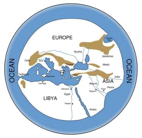
use the map below, based on a map from the sixth century bce, to answer the following qu...

50 !
use the map below, based on a map from the sixth century bce, to answer the following question: picture down below \/ \/
what conclusion can be drawn about the location of the city of syracuse? it was built on the coastline due to easy access to the red sea. it was built on the coastline due to easy access to the mediterranean sea. it was built inland to protect it from invaders sailing in from the mediterranean sea. it was built inland to protect it from invaders sailing in from the red sea.

Answers: 2


Other questions on the subject: History
History, 22.06.2019 10:20, ElizabethMartin6477
Who was the 2nd president of the united states?
Answers: 2
You know the right answer?
Questions in other subjects:


SAT, 30.11.2021 04:40


Mathematics, 30.11.2021 04:40


