
Geography, 09.11.2019 03:31 anayajhughes0603
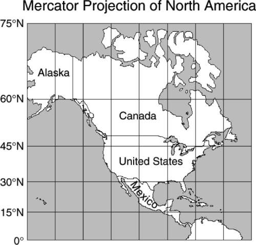
In this mercator map of north america, canada and alaska together appear larger than the united states and mexico together when in fact they are smaller. what causes this distortion?
f the map is a projection of a round world onto a flat surface.
g the latitude and longitude lines create an optical illusion.
h the northern regions are enlarged because the shallower
parts of the ocean are frozen.
j mountains get flattened on a map so that mountainous
areas look larger than they really are.

Answers: 2


Other questions on the subject: Geography
Geography, 23.06.2019 18:30, ashley4329
Which of the following is not a reason why shenzhen, china, is considered an emerging global city
Answers: 2
Geography, 24.06.2019 08:30, hihihi129473838
Arow of elements on the periodic table is called an
Answers: 1
Geography, 24.06.2019 11:10, aaronroberson4940
Where is the temperate deciduous forest located
Answers: 1
Geography, 24.06.2019 11:40, kx85DirtbikeRider
Which of the following is an accurate statement about modern africa
Answers: 2
You know the right answer?
In this mercator map of north america, canada and alaska together appear larger than the united stat...
Questions in other subjects:

Geography, 13.09.2019 21:30


