
Geography, 04.09.2020 07:01 Katmcfee7681
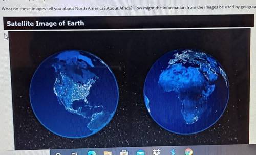
Question 1 of 1 | Page 1 Question 1 (1 point) What do these images tell you about North America? About Africa? How might the information from the images be used by geographers? Satellite Image of Earth WIE

Answers: 3


Other questions on the subject: Geography
Geography, 22.06.2019 21:30, Coolcatfurzy
Name the river that forms a natural border between new york and new jersey and is the site where a passenger jet made a miraculous landing on january 15
Answers: 2
Geography, 22.06.2019 22:00, BrianKeokot4534
There is only one climate type in motion across the world at a time
Answers: 3
Geography, 23.06.2019 21:30, hollandhogenson
Soil is made of air water organic material minerals weathered rock
Answers: 1
You know the right answer?
Question 1 of 1 | Page 1 Question 1 (1 point) What do these images tell you about North America? Abo...
Questions in other subjects:


Spanish, 20.10.2020 14:01


Social Studies, 20.10.2020 14:01

English, 20.10.2020 14:01
Mathematics, 20.10.2020 14:01
Biology, 20.10.2020 14:01


