
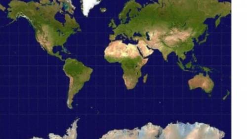
The map projection above was created to use in navigation, but it badly distorts areas and shapes. Which map projection is shown in this image? A. the Mercator projection B. the Goode projection C. the Winkel Tripel projection D. the Special Purpose projection Please select the best answer from the choices provided A B C D

Answers: 1


Other questions on the subject: Geography
Geography, 22.06.2019 21:00, amcd2002
Impressions of tropical swamp plants were observed on rocks in polar regions. the impressions were dark black imprints, which means the fossils are examples of ( 1 ) the fossils tell us that polar regions ( 2 ) ( 1 ) a. carbonization b. mineralization c. trace fossils ( 2 ) a. had tropical plants that can grow in ice b. might have had a diffierent climate in the past c. will have abundent vegitation
Answers: 1
Geography, 24.06.2019 11:10, aaronroberson4940
Where is the temperate deciduous forest located
Answers: 1
You know the right answer?
The map projection above was created to use in navigation, but it badly distorts areas and shapes. W...
Questions in other subjects:


Mathematics, 04.02.2020 22:53

Biology, 04.02.2020 22:53


Computers and Technology, 04.02.2020 22:53

World Languages, 04.02.2020 22:53


