
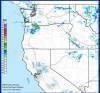
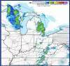
Radar data are used by scientists on computers for generating wind, wind shear, storm intensity, and hazardous weather information. Whenever you view a radar image it is most likely a reflectivity image. They paint a picture of the weather from the energy reflected back to the radar. The dBZ values you seen the map key approximate rainfall rates measured in inches/hour. As you move up the color scale, the higher you go, the more rain that is falling. <15 dBZ means no rain is falling.


Answers: 1


Other questions on the subject: Geography
Geography, 22.06.2019 06:00, Kittylover65
Which of the following is not considered one of the four major oceans (1 point)
Answers: 1
Geography, 22.06.2019 10:00, lizzyhearts
The yellow river is also known as the huang he river? true or false
Answers: 2
Geography, 23.06.2019 00:30, Tboogie2037
Which is a result of the emission from the use of fossil fuel
Answers: 3
You know the right answer?
Radar data are used by scientists on computers for generating wind, wind shear, storm intensity, and...
Questions in other subjects:


Mathematics, 24.03.2021 17:10


English, 24.03.2021 17:10
Mathematics, 24.03.2021 17:10
History, 24.03.2021 17:10
Mathematics, 24.03.2021 17:10


